Weather
Voyager makes getting and interpreting the weather easy
— even fun!
First, while you're working on the rest of the flight plan,
Voyager is downloading up-to-date weather in the background so it will be ready when you need it. No waiting.
Second,
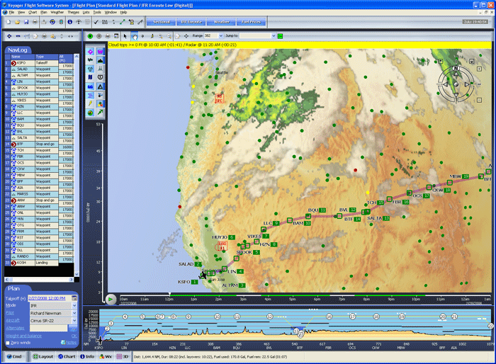
Voyager's exclusive weather graphics make interpreting the weather very easy. For example, on the screen
above you clearly see the satellite image and radar images overlaid along the
route (from Seattle from San Francisco). The clouds, as seen by the
satellites, are shown in varying shades of grey. The precipitation, as
seen by NexRad radar, is shown in greens, yellows and reds.
Altitude and Time Sliders
And,
if you look closely along the route (or look at the screenshot below), you'll see green, yellow and red dots. The green dots mean VFR conditions, red are IFR.
You'll also see wind arrows. As you zoom-in, the wind arrows show exact speed in knots, at the altitude selected by the
Altitude Slider to the left of the Chart (at 9000 feet in the
upper picture, 3000 in the lower). Determining the best altitude, given the winds, is as easy as moving a slider!
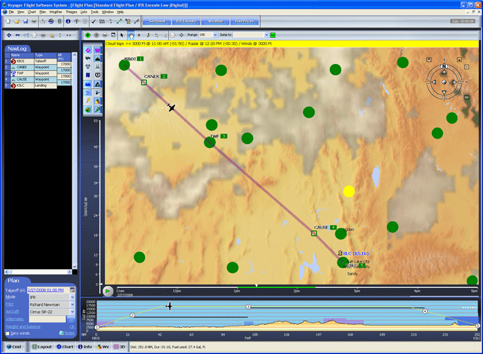
Of course, weather depends on time so
Voyager has another exclusive feature
— dynamic, predictive weather that
we call SmartWeather. On the
Time Slider below the Chart, you'll see two green areas representing our flight time
(the gap is an hour refueling layover). To see how the weather is expected to change during the flight, move the selector along the bar. Or even click the green
Play button to animate!
|
|
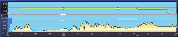
 Profile
In
SmartPlan's
Profile view, the Profile includes valuable weather information.
White bars represent cloud layers. Solid bars are Overcast, dashed
are Broken and dots are Scattered. Just
move the mouse over a cloud to see the description, altitude, reporting
station and relevant time.
The black lines represent airways and their MEAs. |
|
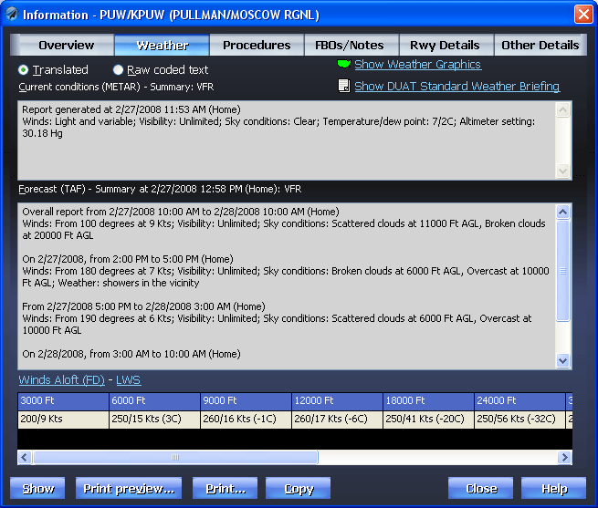
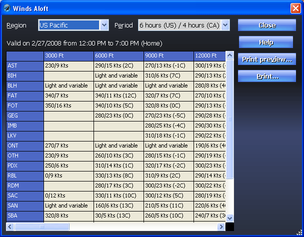
Airport Weather
Want more detail on a particular place? Just click and you'll see up-to-the-minute translated METARs, TAFs and Winds Aloft. Of course, you can also see the original coded text if you like.
If conditions on either the METAR or TAF are expected to be worse than VFR,
Voyager uses yellow and red highlights to warn you. |