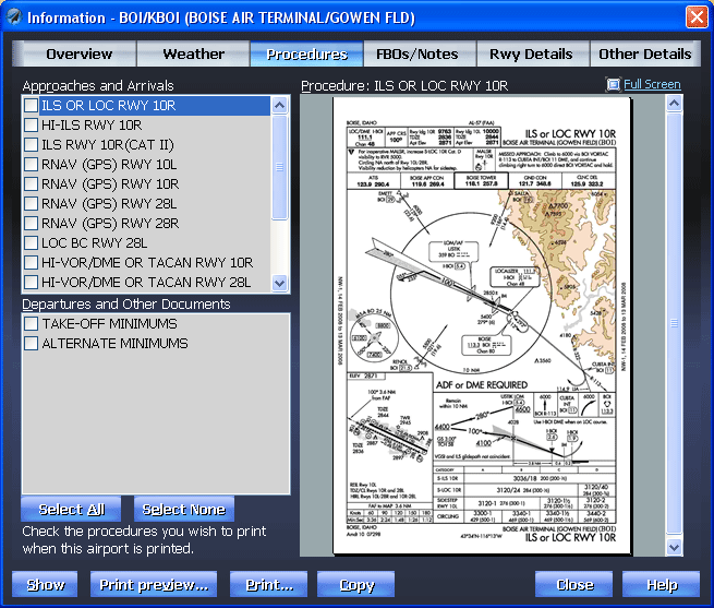
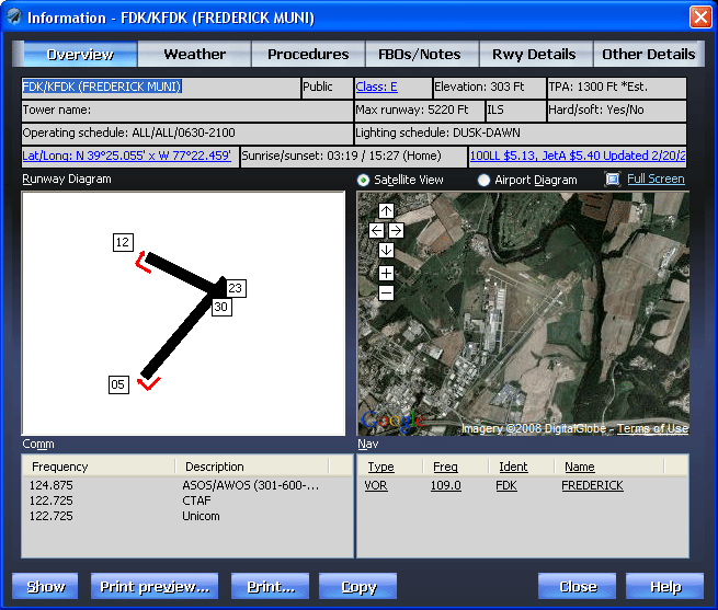
The following screenshots briefly illustrate the different screens that Voyager offers and how simple flight planning can be when you use technology the right way.

Planning a Flight | Weather | Info | Fuel Prices | Synch
Scanned Charts |
Printing | Customizing the Chart | Google/GPS/Other Tools


Info

Voyager makes getting important information fast and easy.  Click an airport on the Chart or enter its ident (or name or closest city) and Voyager shows you the most important flight information in one convenient screen - runway diagram with markers for right-pattern approaches, a detailed airport diagram downloaded from the FAA, Comm and Nav frequencies, etc.

Google Maps

Even better, Voyager links automatically to Google Maps to show an actual satellite image of the airport, invaluable for airports you've never flown to.

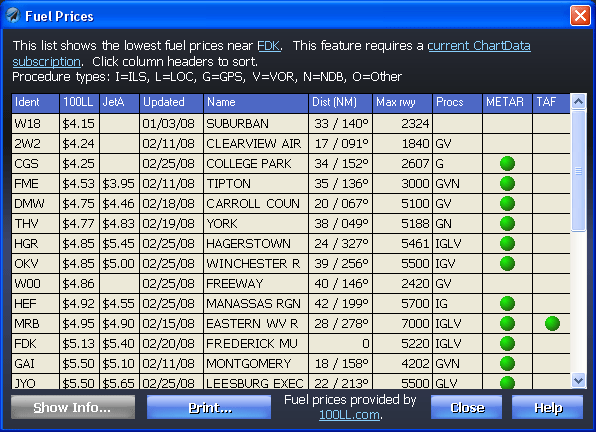
And perhaps best still, through a partnership with 100LL.com, Voyager also downloads and displays current fuel prices at the airport.  You can even click the price (100LL $4.32, in the case below) to find cheaper fuel in the area.


Fuel Prices

NavAids

Want more information about a navaid?  If anything is blue and underlined, it behaves just like a Web page so just click the navaid (above) and see very detailed information.  Not only does Voyager show the frequency but also any airways on which the navaid lies and the MEA to the adjacent waypoints.

FBO Info

If you're an AOPA member, you're in for a real treat as we automatically download the latest FBO information from the AOPA Web site.  This now includes fuel prices from 100LL.com, too, so you can pinpoint exactly which FBO has the best fuel prices and call them to confirm.

This area also lets you enter your own personal notes about the airport (or the food at the on-field restaurant).

Approach Plates

If you have our SmartPlates module, we download current, legal approach and departure plates.  For free!  Fly with a Tablet PC or laptop?  With GlassView, you can see your aircraft move on the plate as you fly.

Airspace

How about clearly seeing where overlapping layers of airspace begin and end.  Just click anywhere on the Chart and Voyager diagrams the information.  Want even more detail, like full text for all TFRs? Just click the blue-underlined text.