|
Want
to see more or less detail on the Chart? Simply click the toolbar to the
left of the Chart.
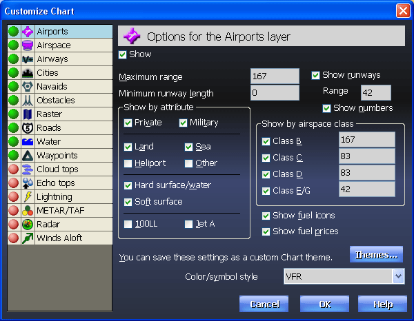
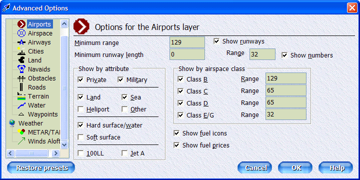
The
icons at the top are general aviation layers: airports, airspace, airways,
cities, land, lat/long lines, navaids, obstacles, roads, terrain, rivers and
lakes and waypoints.
The icons at the bottom are for weather layers: Cloud tops (satellite), Echo
tops, lightning strikes, METARs/TAFs, Radar and Winds Aloft. |