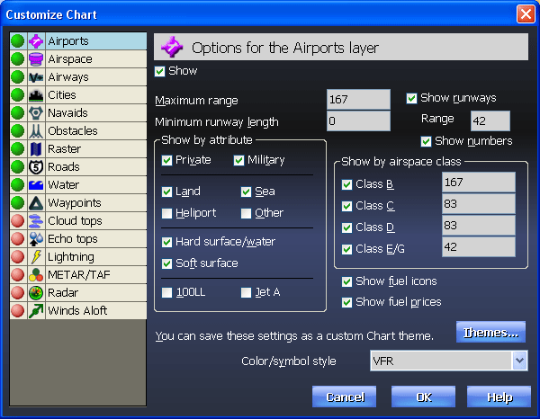
Want to see more or less detail on the Chart? Simply
the
 (Customize) button to turn airports, airspace, airways, cities, terrain, land, lat/long, obstacles, rivers, roads and navaids
on or off (some of these layers, such as terrain and airspace, require using
Voyager with SmartPlates).
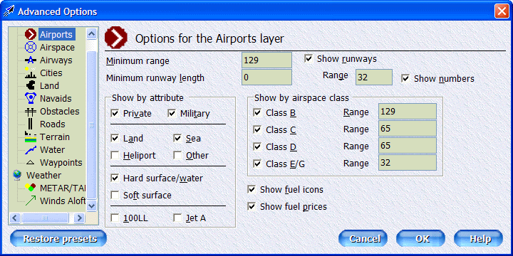
(Customize) button to turn airports, airspace, airways, cities, terrain, land, lat/long, obstacles, rivers, roads and navaids
on or off (some of these layers, such as terrain and airspace, require using
Voyager with SmartPlates). |