
The Easiest Way to Fly Smarter
New Version 7.1
FlyQ+ EFB helps GA pilots fly safer and easier with:
- Intuitive Interface: Minimize screen taps and maximize readability with a design that puts everything you need at your fingertips.
- Crystal-Clear Weather: Get the most up-to-date and impactful weather information, so you can make informed decisions with confidence.
- Affordable: Flying is expensive; your aviation app doesn't need to be.
- The Features You Need: FlyQ+ is filled with exclusive and innovative feature that make flying easier, not bogged down by bells and whistles not used by GA pilots.
*Requires iOS/iPadOS 15 or later (incl. iPads/iPhones built since 2019


More benefits of FlyQ+ EFB
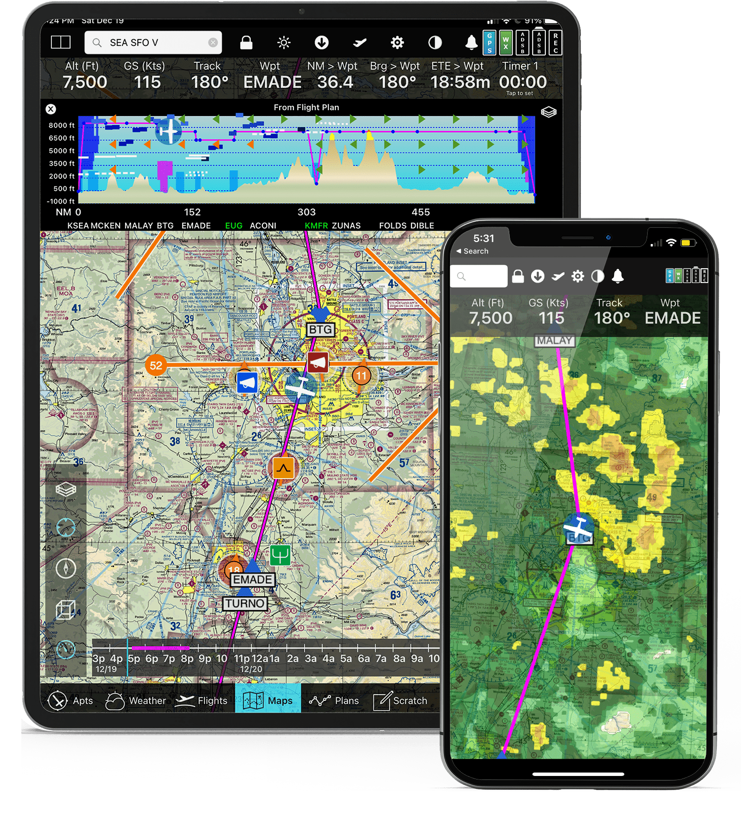
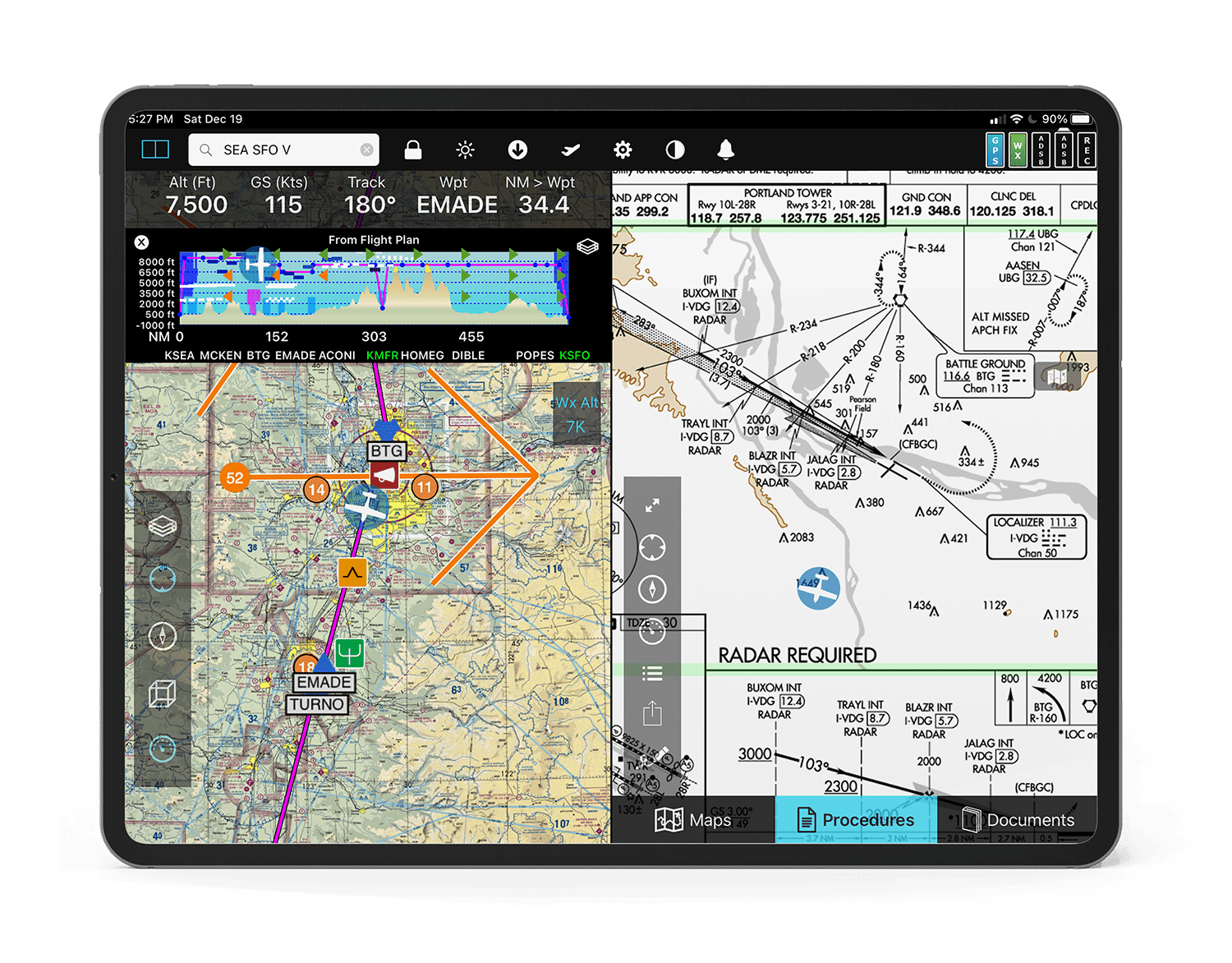
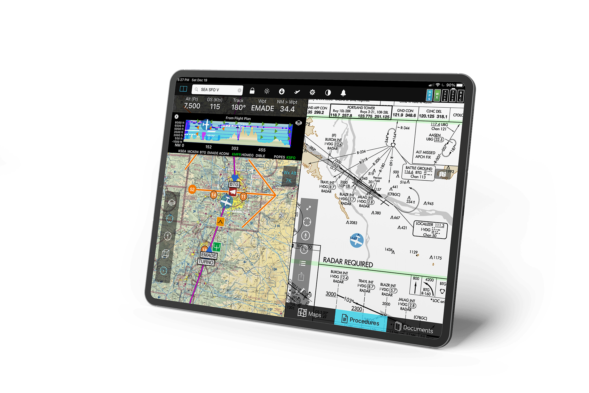
The #1 rated aviation iPad EFB app - simple, full-featured, easy to read.

VFR Runway Pattern selector

Auto zoom to landing

17 Wx Layers with Timeline
Profile View
Altitude Slider
-

ADS-B Targets
-

Airport Detail
-

Recently Cleared ATC Routes
-

Documents
-

Visual Analysis Graphs and Playback
-

Visual Playback in 2D and 3D
-

Visual Logbook Heatmap Details
-

Visual Logbook Heatmap Clusters
-
")
Satellite Map (the photo w/ the airplanes on the runway)
-

Plate / Diagram Annotations
-

Night Mode
-

SA Airport Diagrams
-

Search and Rescue Patterns
-

Flight Recording
-

AIRMETs / SIGMETs
-

Extended Runways Line
-

Airspace Information
-

ChartData Download Manager
-

Weather Gallery
-

Search and Rescue Grids
-

Distance / Time Rings
-

Rubber-band Flight Plan
-

Split-Screen Scratchpad
-

ADS-B Status
-

ADS-B Traffic
-

Wind Optimizer / Terrain X-Ray


")


If you're still using another app, perhaps it's time to ask yourself why.
Download a free trial of FlyQ+ EFB
If you're still using another app, perhaps it's time to ask yourself why.
Download a free trial of FlyQ+ EFB

iPhone and iPad
Aviation’s first practical augmented reality app with airport information, weather and flight planning.


Windows
The quick and easy way to download ChartData for your Dynon, Aspen, Bendix-King, GRT, AFS, and more systems.